🎉 Up to 70% Off Selected ItemsShop Sale
1 / 2
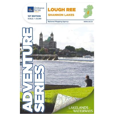
OSI Adventure Series 1:25K Map - Lough Ree
Explore the scenic beauty of Lough Ree and its surroundings with the OSI Adventure Series 1:25K Map. Perfect for hikers and water sports enthusiasts.
Features
- Detailed topographic map of Lough Ree area
- Highlights major towns: Lanesborough, Athlone, and Glassan
- Includes detailed inserts of Athlone and Roscommon town
- Depicts the River Shannon, numerous islands, bays, and lakes
- Features walking routes such as Commons North Woodland Walk and Rinn Duin-Castle Loop Walk
- Provides information on navigation channels, markers, slipways, mooring points, and locks
- Shows major roads: N6, N61, N55, N63, and R392
- Coverage extends to County Roscommon, County Longford, and part of County Westmeath
- Indicated areas for water sports and boat hire on the River Shannon
- Detailed bogs and natural landmarks
$4.80
Original: $16.00
-70%OSI Adventure Series 1:25K Map - Lough Ree—
$16.00
$4.80Description
Explore the scenic beauty of Lough Ree and its surroundings with the OSI Adventure Series 1:25K Map. Perfect for hikers and water sports enthusiasts.
Features
- Detailed topographic map of Lough Ree area
- Highlights major towns: Lanesborough, Athlone, and Glassan
- Includes detailed inserts of Athlone and Roscommon town
- Depicts the River Shannon, numerous islands, bays, and lakes
- Features walking routes such as Commons North Woodland Walk and Rinn Duin-Castle Loop Walk
- Provides information on navigation channels, markers, slipways, mooring points, and locks
- Shows major roads: N6, N61, N55, N63, and R392
- Coverage extends to County Roscommon, County Longford, and part of County Westmeath
- Indicated areas for water sports and boat hire on the River Shannon
- Detailed bogs and natural landmarks