🎉 Up to 70% Off Selected ItemsShop Sale
1 / 2
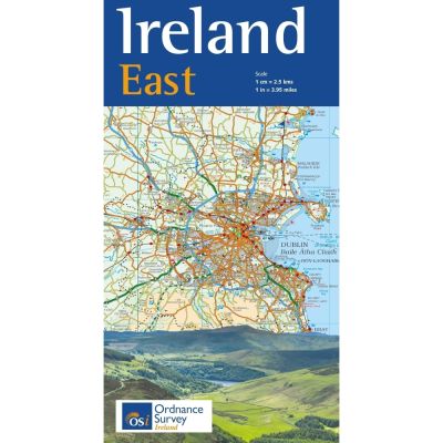
OSI Ireland East 1:250K Map
Discover the beauty of Ireland's east coast with the OSI Ireland East 1:250K Map, showcasing key cities, scenic routes, and historic sites with exceptional detail.
Features
- Detailed Coverage: Covers major cities and towns from Dundalk and Carrick-on-Shannon to Wexford, Waterford, and Clonmel.
- Comprehensive Road Network: Includes all roads from third class to motorways.
- Transport Hubs: Marks Dublin Airport and ferry ports with routes and destinations.
- Rail Network: Displays rail lines and stations for convenient travel planning.
- Natural Features: Highlights prominent rivers such as the Shannon, Liffey, and Boyne, as well as notable lakes and streams.
- Mountain Ranges: Features the Galty, Comeragh, Monavullagh, Knockmealdown, Blackstairs, and Wicklow Mountains.
- Coastal Highlights: Includes Tramore, Hook Head, Saltee Islands, Dublin Bay, and more.
- Historic Sites: Guides tourists to Ireland's Ancient East, including Boyne Valley, Newgrange, Glendalough, and Kilkenny Castle.
$3.43
Original: $11.42
-70%OSI Ireland East 1:250K Map—
$11.42
$3.43Description
Discover the beauty of Ireland's east coast with the OSI Ireland East 1:250K Map, showcasing key cities, scenic routes, and historic sites with exceptional detail.
Features
- Detailed Coverage: Covers major cities and towns from Dundalk and Carrick-on-Shannon to Wexford, Waterford, and Clonmel.
- Comprehensive Road Network: Includes all roads from third class to motorways.
- Transport Hubs: Marks Dublin Airport and ferry ports with routes and destinations.
- Rail Network: Displays rail lines and stations for convenient travel planning.
- Natural Features: Highlights prominent rivers such as the Shannon, Liffey, and Boyne, as well as notable lakes and streams.
- Mountain Ranges: Features the Galty, Comeragh, Monavullagh, Knockmealdown, Blackstairs, and Wicklow Mountains.
- Coastal Highlights: Includes Tramore, Hook Head, Saltee Islands, Dublin Bay, and more.
- Historic Sites: Guides tourists to Ireland's Ancient East, including Boyne Valley, Newgrange, Glendalough, and Kilkenny Castle.